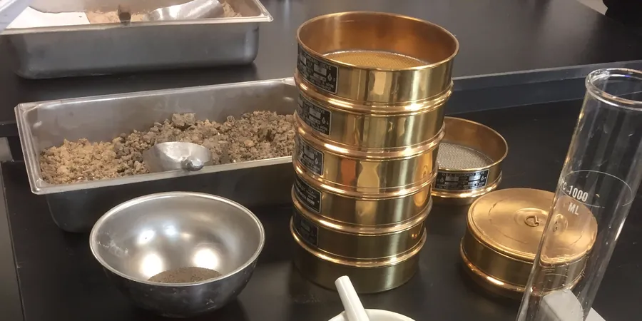
In Drogheda we keep running into the same issue on Boyne Valley sites: a visual log says one thing, but the grain size curve tells a completely different story. That silt layer at 2.5 metres depth looks harmless until the hydrometer picks up 35% clay fraction. At that point, settlement predictions change. Drainage assumptions fail. We run the full hydrometer on every sample from the alluvial flats between the Boyne and the N1—it is the only way to separate true silt from active clay. Some labs stop at the #200 sieve. We do not. For atterberg limits we need the clay fraction first, so the combined sieve-plus-hydrometer becomes the backbone of every classification package we issue for Drogheda projects.
A sieve-only result on Boyne alluvium is half the picture. The hydrometer tells you what your foundation actually sits on.
Local considerations
The north-side estates on higher ground sit on glacial till—dense, gravelly, well-graded. Move south toward the Marsh Road retail parks and you are on soft estuarine silts where the gradation curve shifts entirely into fine territory. We have seen two adjacent sites on the same street produce D10 values an order of magnitude apart. Undersizing the drainage layer because someone assumed uniform sand is the most expensive mistake we correct in Drogheda. A proper grain size curve gives you the filter compatibility check between subgrade and drainage aggregate. Skip it, and the fines migrate into the stone, clog the system, and the pavement fails. The hydrometer step adds maybe two days to the lab schedule. Replacing a failed sub-base costs months.
Applicable standards
ASTM D422-63 (2007) – Standard Test Method for Particle-Size Analysis of Soils, ASTM D6913/D6913M-17 – Sieve Analysis, IS EN ISO 17892-4:2016 – Geotechnical investigation, laboratory testing, particle size distribution, TII Specification for Road Works, Series 600